Category Archives: Water

Catchment to Confluence Complete

River Walk Banner Logo small

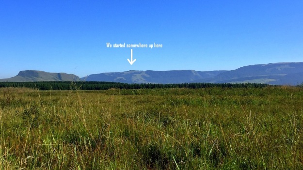
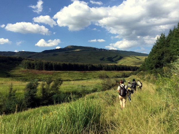
The excitement was brewing as the team were heading to the start of the final leg of the journey along the Karkloof river. This would involve walking the section from below the Karkloof Falls to the confluence where the Karkloof meets the uMngeni River.

Day 6 blog Pic 1

Aerial view of the Karkloof Falls

This entire stretch traverses through the Karkloof Safari Spa property, which is an upmarket private game reserve, lodge and spa with restricted access. This day was set to be a little different from the rest, as we were missing half our team (Ndu and Ayanda), however, we were fortunate to be joined by Jenna Taylor of GroundTruth and Dr. Hans Grobler who is the specialist environmental and wildlife conservation advisor to Mr Worner (the landowner).

Day 6 blog Pic 2 b

From left: Jenna Taylor, Dr Hans Grobler and Sue Viljoen.

The highlight of the day was reaching the base of the Karkloof falls (normally only seen from above) via a winding wooden boardwalk built by the Karkloof Spa.

dav

The boardwalk that leads to the base of the Karkloof falls

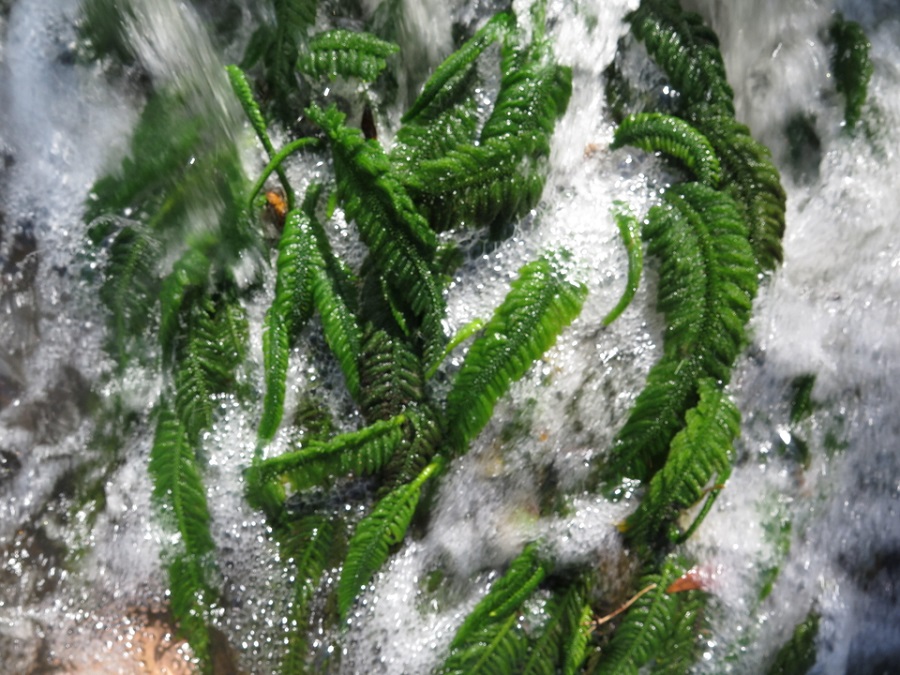
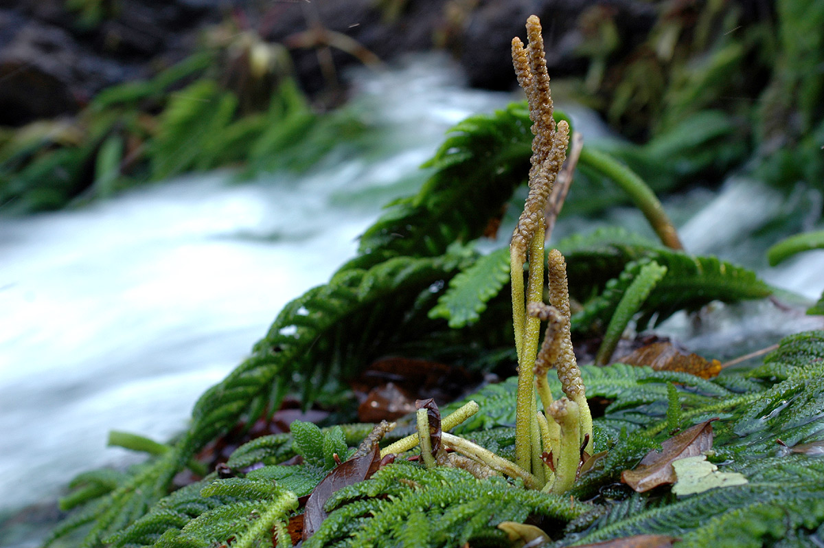
The team enjoyed the lush mistbelt forest with the many flora treasures within, expansive cliffs that tell an incredible geological story, and the damp spray of the waterfall with misty clouds rising above the falls.

Day 6 blog Pic 4 Karkloof Falls Pano

The magnificent Karkloof Falls

In this sacred place where time stands still, and one gets to just soak up the majesty and beauty of one of nature’s natural wonders, no one would guess that we were just 30 minutes from civilisation and the town of Howick.

bty

A team selfie at the base of the Karkloof Falls, which is the starting point for the final leg of our journey.  From left: Twané Clarke (Karkloof Conservancy), Jenna Taylor (GroundTruth) and Sue Viljoen (WWF-SA)

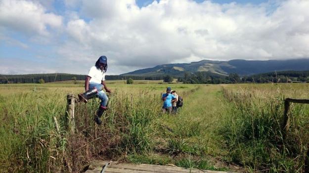
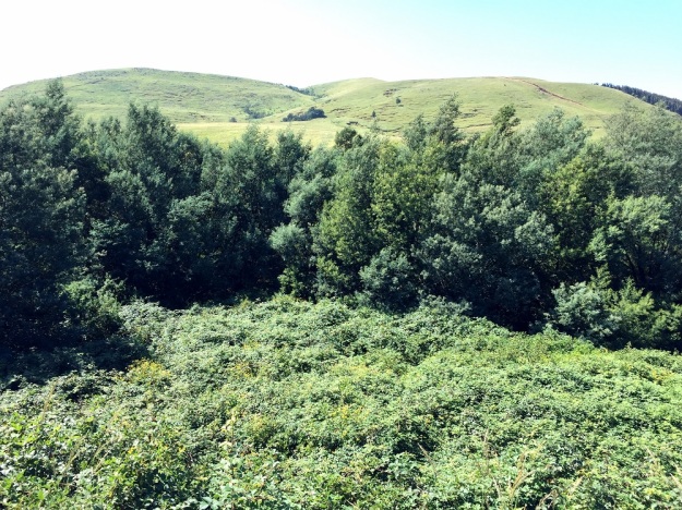
Although the team could have stayed at these magnificent falls all day, they knew they had a journey to complete. Once back out of the forested boardwalk section, the valley opened up into savannah with thorn trees and grassland, with a wealth of indigenous species tracking the river’s course through the reserve.

Flower

Dierama sp.

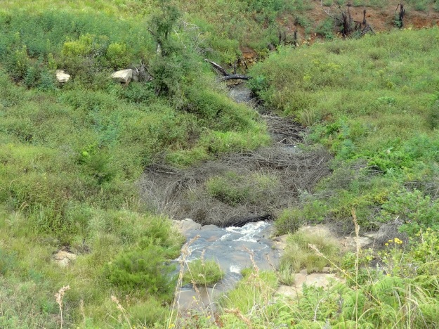
A Buffalo stood watching us quietly from behind a large rock at the river. For at least 8km, the Karkloof’s last stretch before the confluence enjoys natural habitats all along its path, which gives the river an opportunity to heal itself of any impacts experienced higher up in the catchment. Water clarity noticeably improved as well as the levels of dissolved oxygen due to the regular riffles, rapids, and general fast flow of this section.

Natural river veg

Fast flowing river through a natural area.

It is interesting to note that Lantana camara was absent along the entire stretch of river from the source to the falls, but was prolific throughout the last day’s journey. We could see that work was being done to combat this invasive alien plant, as well as many others.

IMG_0093

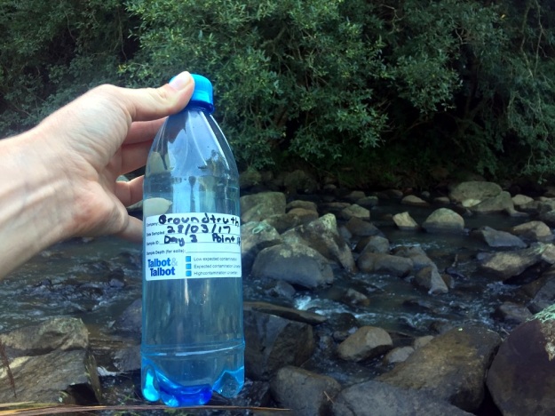
Dr Grobler taking the water clarity reading at the weir for us. The clarity test tube is a brilliant citizen science tool which can be purchased through GroundTruth.

While taking water sample readings near the confluence, a young Spotted-necked Otter peeked its head out of the water with curiosity to see what we were doing. Spotted-necked Otters require clean, good quality water with clear visibility in order to catch fish. It was an encouraging sign to have this sighting at the end of our journey and certainly a highlight for the team.

Spotted-necked Otter

Spotted-necked Otter just above the confluence at the end of our 64km journey,

The team were amused to see that hippo also rely on the Karkloof River as home. Have you ever seen a hippo in a natural flowing river in the KZN midlands? A rare sight indeed. We were also treated to sightings of Eland, Giraffe, Zebra, Bushbuck, Warthog and many more game species.

Hippo three

Hippo enjoying the tranquility of the Karkloof Safari Spa

The river walkers were indeed extremely privileged to have experienced the wildlife and scenery at the Karkloof Safari Spa and are very grateful for being afforded access in order to complete the journey and collect the necessary data along the full stretch of the river.

dav

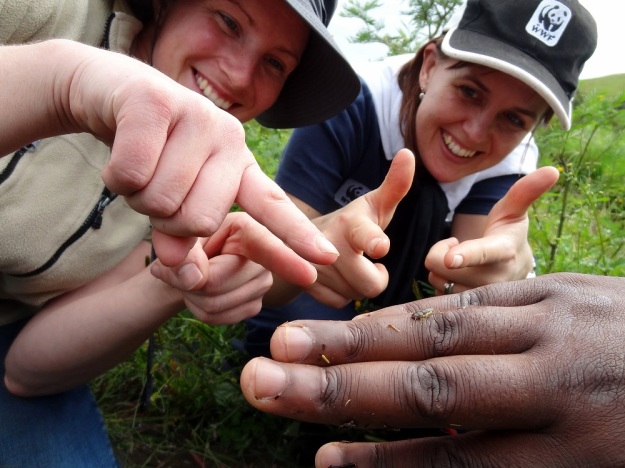
Identifying water invertebrates to obtain a miniSASS score

Very soon after the confluence where the Karkloof river joins onto the uMngeni, we could see the quick deterioration of water quality and the first signs of invasive water weeds on the uMngeni river at Morton’s Drift. Fortunately the Karkloof River is free of aquatic invasive weeds, and will hopefully remain that way.

dav

Mortons Drift. Just below the confluence on the uMngeni River.

The team celebrated the end of the 6 day Karkloof River walk from Catchment to Confluence with sundowners at the top of the Karkloof Falls at the Sappi picnic site, joined by members of the Karkloof Conservancy and WWF staff. A toast was made to the river walk accomplishment and conquering the 64km journey through hill and vale, rain and shine.

IMG_6790

Cheers! To a successful journey.

There is keen interest to see the official results of the river health sampling and the video that is being made of the C2C Karkloof River Walk journey, sponsored by Woolworths. Both of these will be shared at an upcoming Karkloof Conservancy event to be announced.

A huge note of thanks to all the sponsors and partners that have contributed in both cash and kind towards this project, and to the landowners who so willingly allowed access to their properties.

So which river is next? And who else is going to raise their hand to get to know the river in their own catchment?

mde

Great to see the Goble family at the end of our journey. The support from landowners has been fantastic. We look forward to sharing the results with them. From left: Ros Lindley, Fuzz Goble and his mum, Carolyn Goble.

Finally the Falls!

River Walk Banner Logo small

On Day 5 of the Catchment to Confluence Karkloof River Walk the team was thrilled to be joined by 2 fresh pairs of legs, Mbuso Khambule (new SAPPI Environmental Officer) and Mondli Goba (SAPPI Communications Officer), just in time to pass through some of the SAPPI Shafton plantation areas on the Karkloof floodplain.

pic 1

Team setting off. From Left: Nduduzo Khoza (EWT Eco-Ranger), Mondli Goba (Sappi), Mbuso Khambule (Sappi), Twané Clarke (Karkloof Conservancy), Ayanda Lipheyana (GroundTruth) and the photographer behind the camera is Sue Viljoen (WWF-SA)

Our destination for the day was the Karkloof Falls, starting at the pumphouse on Gartmore farm, which as the crow flies did not seem all that far. But we now knew by experience that following the meanders of a river over rough terrain or tall vegetation where there is no path is not likely to be a walk in the park.

Pic 2

Sue Viljoen (WWF-SA) pushing through the tall vegetation in the wetland

As we pushed through the wetland, we stopped to gaze at the distant Karkloof mountains, home to the river’s source where we had come from 5 days earlier, feeling pleased with the distance we had conquered so far.

We started up there

The team felt a sense of pride as we gazed upon the distant mountain

We were excited to see 2 Grey Crowned Cranes fly over us, with their characteristic “mahem” call, en route to one of the bird hides at the Karkloof Conservation Centre. What would Karkloof be without its treasured cranes? We had been treated to sightings of a number of cranes on the previous days as well. In total 11 Grey Crowned Cranes were seen and 4 Wattled Cranes. And it was only fitting that most of these cranes were spotted on farms belonging to “Crane Custodians”.

pic 3

Nduduzo Khoza (EWT Eco-Ranger) and Twané Clarke (Karkloof Conservancy) excited to see these custodianship signs.

Custodians are landowners who are formally recognised by the Endangered Wildlife Trust (EWT) for their voluntary contribution to the conservation of threatened species on their farms, such as crane, oribi or blue swallows. (Download “Guidelines for Custodianship in SA” here)

By tea time, we had traversed the Shafton wetland and reached the Karkloof River bridge which crosses over the road to Cramond.

pic 4

Karkloof River bridge along the Cramond road. From left: Ayanda Lipheyana (GroundTruth), Mbuso Khambule (Sappi), Twané Clarke (Karkloof Conservancy), Sue Viljoen (WWF-SA), Nduduzo Khoza (EWT Eco-Ranger) and Mondli Goba (Sappi)

Mbuso reminded us of the extent of SAPPI plantations that had been removed from the Shafton wetland a number of years ago and allowed to rehabilitate back to natural vegetation – some 186 ha were not replanted due to the existence of this important wetland system.

Pic 5

Looking back at the rehabilitated wetland beyond the bridge.

The next section of the river was slow moving, noticeably poorer in water quality and showed signs of being at the bottom of the valley’s catchment area, which ultimately receives all the nutrient rich runoff from the various activities along the way. The water colour had changed to a more murky greenish colour, there was a type of sludge on the rocks, in some quieter corners, traces of foam was seen on the surface and the sewage weed could be seen in many places along the river’s edge.

River Rockery Pano

At the first set of large, impressive rocks above the falls, we did a Mini-SASS test, which showed the water was “critically modified”, confirming our impressions that the river’s quality was now compromised. At this site, a dead bushbuck was found between the large rocks, leaving us wondering what happened here. It looks like it lost its footing while trying to have a drink.

pic 6

Doing a miniSASS before heading off on the last section to the Karkloof Falls

The condition of riverine buffer along this last stretch was also compromised due to high levels of alien invasive vegetation (such as the big clump of bamboo shown below, poplar saplings, elderflower and all the other commonly seen invasives we had seen higher up in the catchment). Pastures were unfortunately established very close to the river, and therefore without a wide section of natural vegetation to act as buffer and filter for the runoff, the river is all the more impacted.

Pic 7

A clump of bamboo at the river’s edge.

Having followed every twist and turn of the river now for 5 days, we felt a certain sadness at the deterioration of the river’s health. However, the sight of the picnic site for the Karkloof falls picked up our spirits. Destination at last! Hooray for being able to pull off our boots and take a break in the shade! Here we were spoilt with orange ice-lollies by our videographer, Jayne Symes, who is putting a video clip together of the river walk. What a welcome gift! Thank you Jane!

Jane Symes

Jane Symes (Black & White Studios) was our hero that day. These ice cold treats were welcomed after a day of scorching heat and little shade.

While catching our breath over lunch, we chatted at length about the problem of litter at a public picnic site like this, and how increasingly popular the Karkloof Falls had become. Would new signage saying “litter free zone” and removing the dustbins help to change people’s behaviour so that all rubbish is taken away by visitors?

pic 8

Karkloof Falls picnic site along the river could be the perfect setting for a litter free zone

There was just 1 section left to walk down to the actual Karkloof falls viewing point and lower picnic site, our end point for the day. We said “bye for now” to the river, with the very last leg of the river’s journey to be continued the following Thursday, 6th April. A team photo in front of the falls was a fitting way to exclaim “WE MADE IT!”.

pic 9

We made it! The Karkloof River Walk team have reached the Karkloof falls

A Winding Watercourse

River Walk Banner Logo small

After difficult and long days, Day 4 promised to be less strenuous as the team were now truly in the Karkloof floodplain, where the terrain was more open and the river starts its characteristic meanders.

DSC_1889

With Sue Viljoen (WWF) unable to join us for day 4, Simon Bruton of GroundTruth stepped in as a substitute for the day.

DSCF1465_edit

Day 4’s river walk team. From left: Twané Clarke (Karkloof Conservancy), Simon Bruton (GroundTruth), Ayanda Lipheyana (GroundTruth), and Nduduzo Khoza (EWT Eco-Ranger)

Given the open terrain, by tea time we could see in the far distance the start of a line of trees, the end of which marked our finish point for the day. However, we knew there was still much walking ahead, given the many meanders, oxbow lakes and fences we would still need to navigate.

IMG_6090

On the floodplain cattle became a common sight, along with some of the impacts and risks they can introduce in proximity to watercourses. Eroded cattle crossings, drinking and feeding points (with associated cattle dung and trampling) contributed to water which showed gradual but increasing visual signs of change such as cloudiness, froth and abundant growth of nuisance vegetation, possibly thriving on an increased nutrient load. It will be interesting to see if the laboratory water quality analysis sponsored by Talbot & Talbot confirm the visual observations.

DSC_1944

Sewerage plant along with other signs of deteriorating water quality

Days 3 and 4 were the days of fence crossings. Given the fatigue setting in, humour was found in the different ways each of us may tackle a fence in the least strenuous manner, given our different loads and skills. Some would prefer to vault over and leave pack and kit intact, while others would disrobe all kit, squeeze through and kit up again.

DSC_1914

Ayanda negotiating yet another fence

Given the many meanders and fences, a tree trunk footbridge was a welcome but tricky crossing to negotiate.

DSC_1991

Negotiating the log bridge

Twané showing the muscle required of a river walker.

DSC_1926

After lunch we made a poor call on which side of the river to take, ultimately resulting in the need for a detour around a large mosaic of impenetrable wetland vegetation, which separated us from the river for some distance. Once re-united, water quality samples were again collected.

IMG_6016

At the tar road bridge over the Karkloof River, illegal and irresponsible dumping of waste tar material into the river was noted, posing a significant constriction to flow, and perhaps even affecting flood risk to the bridge, with one of the two culverts effectively barricaded.

DSC_2041

Waste tar material dumped off the Karkloof tar road bridge, introducing river impacts and potential flood risk

In the early afternoon Ouhout, Leucosidea sericea, was again found for the first time since the headwater sections. Numerous alien plants still made their presence felt (particularly bramble and bugweed), but not in the same densities that had been experienced on day 3. Having said that, some large isolated patches of bramble required some cautious retreat and detour.

DSC_2050

Nduduzo taking a water clarity reading at one of the last water quality sites of the day.

DSC_2059

As dusk approached and each camp fence was crossed, the team were joined by relays of inquisitive river walkers who call this beautiful area home.

DSC_2072

Bushwillows, Bushbuck and Bushwhacking

River Walk Banner Logo small

on Tuesday 28 March, as we reached our drop off point for day 3, courtesy of C. MacGillivray’s Karkloof Taxi Services, Sue Viljoen (WWF-SA) remarked that she was in need of a double espresso and a red bull. Yip, the typical day 3 stiffness had set in, and our bodies were yelling for more sleep and wondering why on earth we had volunteered to walk from dawn to dusk through some rather difficult terrain. Once we were on our way, with the morning mist rising and the river looking really beautiful, we soon forgot our morning blues.

IMG_6260

The Karkloof river, our source of inspiration

A hidden gem was waiting for us a few river bends later. Grassy river banks suddenly gave way to a small pocket of riverine forest and invited us in to explore. If we did not have at least another 10km to conquer that day, we would have loved to linger under that quiet, shady tree canopy created by some impressively tall forest trees, including Sue’s new favourite – The Forest Bushwillow (Combretum kraussii).

IMG_6259

Close-up of the Forest Bushwillow

We wondered how old this particular bushwillow was – maybe a good 50 to 90 years?

IMG_6258

Standing under the impressive Bushwillow

However the fantastical forest patches were soon forgotten when we saw the sad sight of green algae in a slow moving section of the river, a sure sign of nutrient enrichment.

IMG_6264

Green algae – a sign of nutrient enrichment

When we stopped at the next suitable place to take water quality samples, the mini-SASS result reflected a decline in river health.

IMG_5876

A sample to test for E. coli, nitrates and phosphates was definitely in order.

From this point on, the condition of the river bank vegetation also declined considerably with a proliferation of alien invasive vegetation, particularly bramble, which required frequent bushwhacking and made walking close to the river very difficult. We had to take a number of detours around or through plantations and lost sight of the river for a fair distance, often due to a hedge-like wall of bramble that separated us from the river.

IMG_6263

Wall of Bramble separating us from the river

We also came across 2 large areas of erosion on exposed, steep river banks.

IMG_6265

Riverbank erosion causes increased sediment deposit in rivers during rainy and stormy weather which leads to the silting up of rivers and dams.

While gazing at the extent of the erosion, a bushbuck suddenly bolted out and made a quick disappearance again. What a treat to see one of these shy antelope! Another boost to our spirits was coming across a few more forest patches with giant-size Bushwillows, Cape Chestnuts and Cabbage Trees.

Three noteworthy sightings from today can adequately be summed up as – The Good, The Bad and the Ugly.

IMG_5919

The Good – Beloved Bushwillows

IMG_6261

The Bad – Formosa Lilies (Lilium formosanum) an emerging weed, which despite its aesthetic appeal is spreading rampantly.

IMG_5953

The Ugly – Bulldozer activity, altering the river banks and clearing vegetation. Such disturbance is likely to attract more invasive weeds.

When we finally got back to the river’s edge and put some of the more difficult terrain behind us, we came to one of the five fixed sampling points where water quality and river flow is sampled weekly by GroundTruth. This is part of a river monitoring project for the Karkloof Irrigation Board, funded by WWF-SA, along the Karkloof and Kusane Rivers. We were encouraged to find a stonefly at this site, doing a fine display of “push-ups” for us, whereby it pushes its body up and down with its legs which is one of the distinguishing features of stoneflies compared to other aquatic invertebrates.

IMG_5993

Our “bodybuilder”, the Stonefly which was doing push-ups for us.

Seeing time fly by, we had to press on to try reach the pick up point before dusk. A new landscape lay before us of beef grazing peacefully on rolling hillsides, maize lands and lush dairy pastures. The change in land use was also coupled with a change in river characteristics, as the river flow slowed down over flatter floodplain terrain, and began to meander more and more.

IMG_6001

After a long day, seeing our trusty steed comes into view (a certain white Prado) was truly a welcome sight – and one which deserved a silly photo to celebrate!

IMG_5982

SAPPI Saunter

River Walk Banner Logo small

On Monday, 27 March the eager walkers were greeted with a clear sky for Day 2 of the Karkloof Catchment to Confluence River Walk. We were thrilled to have Hlengiwe Ndlovu, an environmentalist for Sappi, join us for the day and share her expertise and knowledge with our team for this vitally important project.

IMG_5830

Day 2 River Walkers. From Left: Sue Viljoen (WWF-SA), Hlengiwe Ndlovu (SAPPI), Twané Clarke (Karkloof Conservancy), Nduduzo Khoza (EWT) and Ayanda Lipheyana (GroundTruth)

The team were dropped off at the same point that we ended at on the previous day and started a new Riparian Health Audit (RHA) to measure the quality of the upcoming river stretch. A miniSASS study along with water chemistry tests were also conducted.

IMG_6257

Testing water clarity

The journey along this first RHA section yielded a “Fair” result, which had been the lowest score we’d gotten since the source of the Karkloof river. We anticipated that the results would show a decrease in river health, as we had come across the first sign of humans since starting on our walk.

IMG_5772

Signs of human life (a rare sight since Day 1’s walk)

Hlengiwe was enthusiastic about the River walk: “I think the project will provide valuable “point information” of where/what impacts occur along the river for the landowners to enable targeted action. It will also be worthy in providing positive feedback to landowners who’ve completed good rehabilitation interventions.

IMG_5825

Hlengiwe Ndlovu (SAPPI) was thrilled to walk along the Karkloof River with us.

This RHA area was badly infested with Wattle and Bramble; there were signs of litter and small scale dumping; and Ayanda Lipheyana of GroundTruth pointed out the “Sewerage plant” which grows along river banks where there is a high nutrient load in the water. This warranted a sample to be taken for E. coli, Nitrate and Phosphate tests to be done. These samples are sent daily to Talbot and Talbot who have kindly donated their time, equipment and expertise for this project.

IMG_5774

A portion of the Bramble infestation.

We soon entered Plantation territory, where the team were treated to interesting stories from Hlengiwe about the challenges they face when planning Invasive Alien Plant control within the plantation areas.

IMG_5787

This walk has inspired some valuable discussions while sharing thoughts and ideas.

The team were impressed with the progress that has been made by SAPPI in the stretch we were walking for the day.


IMG_5829

Appreciating the healthy looking riparian zone between the two plantations.

The riparian zones were looking healthy and we had an easy walk through the grasslands, appreciating the lack of bramble hooking onto our clothes and skin.

IMG_5806

The team enjoying a bramble-free walk

Hlengiwe pointed out the Bracken in a few areas, telling us about the nightmare in trying to control this pioneer species. This plant is a common sight in the KZN Midlands, turning a beautiful golden brown colour in the autumn. There was a consensus in the discussions between the team that the most effective way in controlling the spread of this plant is to keep it short and cut the regrowth at its early stages.

IMG_5826

Hlengiwe Ndlovu (SAPPI) pointing out the Bracken that proves difficult to remove.

As the team saw their homestretch to the end of day 2, Ayanda’s foot managed to find an animal’s home on the grassland slope, unfortunately twisting his ankle in the process. One of the dangers of walking through unpathed areas.

IMG_5824

Ayanda getting his ankle strapped by Nduduzo to help him reach our end point at the bridge in the background.

Hlengiwe commented: “I enjoyed being up close and personal to the river, which is a rare opportunity as one often sees the river in bits and pieces. I also enjoyed the anecdotal stories from the team of the different “river experiences” we’d all had and how we’ve all experienced the Karkloof thus far.

IMG_5828

A happy team at the end of Day 2. From left: Nduduzo Khoza (EWT), Ayanda Lipheyana (GroundTruth), Hlengiwe Ndlovu (SAPPI), Charlie MacGillivray (Karkloof Conservancy and our amazing backup, support and driver), Twané Clarke (Karkloof Conservancy), Sue Viljoen (WWF-SA)

Our sincere thanks to all sponsors and landowners who have made this walk and study possible. So far it has proven to be an extremely valuable exercise and we look forward to the rest of the journey.

Source Seeking and Catchment Clambering

River Walk Banner Logo small

Clamber (verb): to climb or move in an awkward and laborious manner, typically using both hands and feet.

This sums Day 1 up quite adequately, especially whilst we were trying to find the source of the Karkloof River! The source proved to be well hidden within a thicket of Ouhout, Leucosidea sericea, mixed with some other indigenous shrubs and trees such as the Nana-berry, Searsia dentata, and a few ferns and creepers.

Source team

The river walk team at the source of the Karkloof river

The river walkers were ready to start their intrepid journey of the first 10.6km of the Karkloof River at 7am, with a light misty drizzle – typical of the Midlands mistbelt. Our team comprised of Twané Clarke of the Karkloof Conservancy, Ayanda Lipheyana from GroundTruth who do routine water quality monitoring for the Karkloof Irrigation Board, Sue Viljoen of WWF-SA who have been working on a number of Water Stewardship initiatives in the Umngeni catchment, and Nduduzo Khoza an Eco-Ranger for the Endangered Wildlife Trust (EWT).

River walk team

Off we go… From left: Sue Viljoen (WWF-SA); Nduduzo Khoza (EWT); Ayanda Lipheyana (GroundTruth); and Twané Clarke (Karkloof Conservancy)

The team followed the stream until they reached a sight with sufficient water to begin the first set of water quality sampling techniques. These methods will be repeated down the length of the Karkloof river to build up a better picture of the river’s current status quo.

MiniSASS

MiniSASS – identifying the invertebrates to determine river health

Tests included a miniSASS (using aquatic invertebrates to determine river condition), a Riparian Health Audit (RHA) and taking water quality readings such as pH, clarity, dissolved oxygen and temperature. All results have been captured on smart devices using a new app called GeoODK, which GroundTruth have customised for river monitoring purposes.

IMG_5618

Testing the clarity of the water

Most miniSASS tests indicated good condition, with one site boasting near natural conditions. The highlight of the day was finding an elusive Stonefly at this site which is known to be the most sensitive invertebrate to river impacts.

stone fly

Yes folks, that little insect made our day!

The site that only had a fair condition was possibly indicating the impact of erosion, invasive alien vegetation and log jamming.

log jamming

An example of log jamming. Removing these obstacles in the river will make a world of difference.

We were all fascinated by the abundance of Ouhout growing  along drainage lines, gullies and riverine areas. We’re particularly interested to find out from the locals about the history of this area and whether these trees have always been here or if it has gotten denser through the years – ideas welcome.

Ouhout

Overall, we were quite surprised by the extent of the impacts so soon in the river’s journey. Wattle, Bramble and Blackjack are prevalent and will require large scale and carefully planned clearing, with assistance of other organisations, if the vision of an alien free Karkloof river is ever to be realised.

bush whacking

We were also treated to some of the most beautiful scenery,

Panoramic view

unique flowers,

purple flower

spoor of what we suspect to be a Brown Hyaena that we followed for a while,

Hyaena spoor

and lots of frogs.

Ndu Kisses a frog

As the sun began to set over the picturesque hills, we realised we were chasing the clock to reach our final point before dark. The flying ants glistened in the dusky light and the temperatures began to drop.

sunset flying ant photo

The team finally reached the end at 6:30 pm where we were warmly greeted by Charlie MacGillivray who is both a landowner and the Chairman of the Karkloof Conservancy. Let’s hope Day 2’s stretch of the Karkloof river is kinder to us.

Our sincere thanks to all landowners who gave us permission to walk on their properties today. We thoroughly enjoyed exploring your part of the Karkloof which set the tone for the rest of the journey.

Celebrating World Wetlands Day

Article supplied by the Endangered Wildlife Trust.

World Wetlands Day, celebrated annually on 2 February, provides an opportunity to celebrate a natural resource that is critical for people, the environment, and biodiversity. Wetlands come in all shapes and forms, from estuaries along our beautiful coastlines and high altitude inland wetlands within the grasslands of Mpumalanga, to the hard working wetlands within our urban landscapes. Much of our conservation effort within the Endangered Wildlife Trust (EWT) is centred around the protection, restoration, and management of wetlands and the catchments that feed them, and we encourage you to celebrate World Wetlands Day with us.

wetlands-day

Two of South Africa’s three crane species, the Grey Crowned and Wattled Crane, are completely dependent on wetlands for their survival – yet both are threatened with extinction. Their threatened status mirrors the loss of wetlands in our country, with an estimated 50% of wetlands completely transformed in South Africa. The African Crane Conservation Programme (ACCP), a partnership between the EWT and the International Crane Foundation, has used these charismatic, long-lived birds as flagships for wetland protection, restoration and management.

The ACCP’s South Africa Regional Manager, Tanya Smith, confirms that the efforts of the ACCP team and its partners have ensured the protection of nearly 100,000 ha of grasslands, wetlands and associated rivers in important catchments for people and cranes in South Africa over the past five years. The protection of the key water resources contributes to the long-term security of our water supply for millions of people in South Africa.

Wattled Cranes

Pair of Wattled Cranes at the Karkloof Conservation Centre – By Patrick Cahill

From large charismatic cranes to the small and slippery, wetlands are home to many. Globally, amphibians are the most threatened class of vertebrate with 32.5% of species currently listed as Critically Endangered, Endangered or Vulnerable. Approximately 800 species of amphibians make exclusive use of wetland habitats. Here in South Africa, a tiny frog the size of your thumbnail is found only in 25 wetlands along the KwaZulu-Natal coastline. Therefore, a key focal species of the EWT’s Threatened Amphibian Programme (TAP), is the Endangered Pickersgill’s Reed Frog. These coastal wetlands are unique in their structure and are themselves classified as Critically Endangered. “The presence of flagship species that depend on wetlands for their survival really helps leverage support for the protection and restoration of wetlands,” says Dr Jeanne Tarrant, TAP Programme Manager. The EWT embarked on an ambitious journey to restore four of these wetlands in the Durban area through alien plant control, re-establishment of indigenous plants and assessing wetland rehabilitation needs and this year will be working towards formal protection of two of these wetlands through community stewardship models.

This year’s World Wetland Day theme is “Wetlands for disaster risk reduction” and this theme truly celebrates the services wetlands provide for us free of charge. Wetlands greatly reduce the impacts of flooding by slowing down the flow of water, and reduce the impacts of droughts by slowly releasing water to our streams and rivers. In the current drought gripping much of South Africa, the role and protection of healthy wetlands has never been more important.

silindile learning about wetlands

Slindile students learning about the importance of wetlands

The EWT is involved with several World Wetlands Day celebratory events around the country. In KwaZulu-Natal, World Wetlands Day will be celebrated at the Greater Edendale Mall wetland in Pietermaritzburg on 2 February from 10am. This is a collaboration of all partners of the KwaZulu-Natal Wetland Forum and will see over 300 children learning about and experiencing the value of wetlands. In the Eastern Cape, the EWT and the Wildlife and Environmental Society of South Africa have partnered to get our future generation’s hands dirty experiencing the wetlands of the Amathole area, where the EWT has been implementing catchment restoration work for the past three years. Lastly, in Gauteng, World Wetlands Day will be celebrated on 17 February at Tembisa Esselen Park Pan. A fun day of activities is planned, so be on the lookout for the EWT stand.

Later on in the month, you can get involved in raising awareness for our special wetland dwellers, the frogs, by joining in on a number of Leap Day for Frogs activities, including the EWT’s attempt to break the Guinness World Record for the largest game of leapfrog on Friday, 24 February. This exciting event gets underway at 10am on the Durban beachfront promenade near uShaka Marine World. Find out more by visiting www.leapdayforfrogs.org.za or emailing JeanneT@ewt.org.za

Yellow-striped Reed Frog 1 - Nick Evans

Yellow-striped Reed Frog by Nick Evans

You can make a difference to our wetlands all year round in a number of different ways, including:

  1. Planning a wetland clean up in your community with local schools and parents.
  2. Reducing your waste, reusing bottles and containers you would normally throw away, use reusable shopping bags and recycle! Our water resources like rivers and wetlands are heavily impacted on by litter and waste, so these small actions can make a huge difference.
  3. Reporting any illegal dumping in wetlands and rivers to your local municipality or police station.
  4. Supporting the efforts of organisations like the EWT in protecting wetlands on your behalf.

Useful resources to learn more about World Wetlands Day 2017:

Threatened Plant Species – Hydrostachys polymorpha

HYDROSTACHYACEAE: Hydrostachys polymorpha [Vulnerable]

Meet this unusual plant, Hydrostachys polymorpha, a perennial aquatic fern-like herb which is unable to survive without the turbulence of the water. Living life on the edge takes on a whole new dimension with this plant that has found a perfect formula for adhesion, nature’s very own super glue, allowing it to cling onto the rocks and thrive in the white waters which give rafters a thrill.

Hydrostachys polymorpha by Alexander Rebelo

Hydrostachys polymorpha by Alexander Rebelo

This plant is found on the rocks in the fast flowing fresh water within the Umgeni Valley Nature Reserve, Umvoti and Krantzkloof Nature Reserve and the presence of the species is greatly affected by habitat degradation, river pollution, harvesting for medicinal use and most importantly reduced water flow.

Hydrostachys polymorpha grows up to 400 mm high. The leaves of the plant are basal and remain submerged in water. Leaves are 100 – 400 mm, contain small leaflets that are curled up, which gives the leaf a coarse wart-like appearance. The petiole and axis of the compound leaf are flat and coated with several wart-like outgrowths that are sometimes winged. Pinnae (leaflets of a pinnate leaf) are sub-opposite, numerous, spreading and 30 mm long.

Photograph by D. Gwynne-Evans

Photograph by D. Gwynne-Evans

Hydrostachys polymorpha flowers from May to August. The plant contains a spike inflorescence with alternate and sessile flowers along a common unbranched axis. The spike is erect above the water and dioecious (male and female flowers are borne on separate plants). The male and female are similar, strong, and occasionally smooth, grow to 300 mm long and occur from the base of the plant. The stalk is leafless, strong, and occasionally smooth. The male flowers have overlapping bracts that are broadly egg-shaped with very small bumps near the pointed apex and recurved margins. The female flowers have bracts that are shaped like bivalve molluscs, 3 mm long and a lip-like tip with a central nerve extending downwards.

The fruit of Hydrostachys polymorpha are flattened, smooth, egg-shaped and hidden inside the bract. The seeds are small and orange.

Remember to report sightings of these naturally occurring plants to Suvarna Parbhoo, CREW programme: KZN Node Manager s.parbhoo@sanbi.org.za

References:

  • Obermeyer A.A. 1970. Flora of Southern Africa 13: 211
  • Sieben, E., von Staden, L. & Raimondo, D. 2006. Hydrostachys polymorpha Klotzsch ex A.Br. National Assessment: Red List of South African Plants version 2014.1. Accessed on 2015/06/04

Don’t Fiddle With our Water Factories

In nature, there is no magic water factory – the water on the earth now is the same water that has been here since the beginning of time. Whether in the Karoo or the forests of the Congo, the basics of the water cycle are the same: Water falls on the land as rain, snow, sleet, hail and mist, runs into our rivers, fills our dams and underground aquifers, and flows out to the oceans. The sun evaporates this water, clouds form and some of it falls again on the land. This is the water that we all use. Only 3% of the water on our planet is freshwater (as opposed to saline) and only 1% is available for our use.

f

South Africa is a water scarce, semi-arid country, and unfortunately, even the little water we do have is often badly managed, used wastefully and polluted. It seems crazy then that hydraulic fracturing (fracking), which uses a lot of water AND contaminates water, should even be considered an option to boost our energy resources! A number of technical cooperation permits have been issued in the Midlands and Berg foothills, which give the holders rights to research the area as a desktop exercise with a view to fracking. In order to verify the amount of shale gas present and its viability as an energy source, prospecting or exploration as it is termed in the oil and gas sector, will need to take place. This activity has the potential to affect groundwater quality as it uses hydraulic fracturing techniques.

f13

The KZN Midlands is a National Freshwater Ecosystem Priority Area. The role of the Drakensberg and foothills as the ‘water factories’ of Kwa Zulu Natal cannot be underestimated. Intact grasslands are important for storing rainwater in wetlands or as ground water which is gradually released throughout the year. It is vitally important to protect these areas which sustain the flow of clean water, supporting the lives and livelihoods of nearly 6 million people downstream. Other free ecosystem services provided by these Midlands grasslands include pollination, soil production, flood water attenuation, carbon storage, cultural and recreational amenities and support to subsistence livelihoods. The uMngeni River catchment supplies 1000 million litres per day of potable water to a vast area including Howick, Hilton, Edendale, Wartburg, Vulindlela, most of Durban and Pietermaritzburg.

f6

The Midlands Conservancy Forum (MCF) opposes, on ecological, social and economic grounds, the use of fracking to recover natural shale gas. Specifically, the MCF believes that the risk of contamination of groundwater in an already water-stressed environment is simply unacceptable. Despite assurances from potential extractors that the technique is safe, evidence of failed safety measures and resultant contamination is increasingly common in areas where fracking has been undertaken, even under first world conditions. We can’t drink gas! Want to be better informed about this issue?

f15

Learn more here: http://www.midlandsconservancies.org.za/prpagefracking.php

Our River, Our Responsibility

A small river which is entirely ours

…and therefore entirely our responsibility

– By Adrian Flett of Rosetta/Nottingham Road Conservancy

A small but significant tributary of the Mooi River rises in the hills to the west of Nottingham Road, flows eastwards and under the R103 at the edge of the village. It feeds an extensive wetland and flows north towards Rosetta, where it again passes under the R103 and is the source of Rosetta Dam before it joins the Mooi River. This makes it a contributor to water in Midmar Dam through the Mearns Transfer pipeline and therefore a source of water for Durban and Pietermaritzburg as well as several other smaller centres.

RNR 0

We have been told that years ago the local children caught fish in this small river, which we have heard referred to as Springvale Stream and for want of another name right now, we will use that name here.

Springvale Stream faces so many challenges and impacts in its relatively short journey to the Mooi, that it is difficult to imagine a worse situation for a rural river. And although many of us pass the stream at least once a week, we are so used to what has been happening over the years that we simply accept what has and is being done. The whole catchment of the river is within the boundaries of the RNR Conservancy and offers a great opportunity – and a great challenge.

RNR1

The less disturbed riparian areas along the river have so many flowers that it makes us wonder what the original little river with its wetlands must have been like: a real wild garden! There is not much we can do about some of the impacts but we can certainly take care of what we have left and it would be gross negligence not to do so. We hope to survey sections of the stream little by little to build up a picture of the biological diversity and we will be asking for specialist help for some of this work. But in the meantime we appeal to all the community to be aware of “Our River” and the activities along its course.

The wetland contains multiple flower species and deserves a formal survey.

The wetland contains multiple flower species and deserves a formal survey.

The main stream rises in hills partially covered in plantation forestry. When it reaches Nottingham Road and the R103 it has to contend with various industrial developments and we see that “platforms” are still being made for further development out into the wetland which has colonies of kniphofia and gladiolus (probably dalenii both bright orange and brown) . Have these developments all had the go-ahead from an Environmental Impact Assessment? Surely not! Has the stream reached the stage of being written off environmentally?

RNR3

The R103 itself has had an impact on the water flow into the river but the good news is that Shea O’Connor School is a WESSA Eco School and have taken the small tributary on their school grounds seriously. The railway line of course has had a huge impact on Springvale Stream and its wetlands. We cannot change the road or the railway line but we can monitor pollution along these and remove alien invasive plants like bramble.

The stream flows immediately below the rocks which form the bank on the R103 where a truck recently broke through the Armco barrier and had to be winched back to the road. The rock hyrax colony lives in these tumbled rocks.

The stream flows immediately below the rocks which form the bank on the R103. A truck recently broke through the Armco barrier and had to be winched back to the road. The rock hyrax colony lives in these tumbled rocks.

A new and very large impact on the Springvale Stream is the building of the Springrove Dam transfer pipeline. Again, this cannot be altered but some of the activities related to the pipeline require mitigation. An immediate example is the gravel platform at the entrance to Springvale Farm just off the R103 where this gravel is eroding into a wetland area filled with wild flowers and at least one “muti” plant, Gunnera perpensa.

springrove dam

Springrove dam

Along the middle section of the stream, conservation-based farming attitudes have ensured that reedbuck may frequently be seen from the R103 in the early mornings and evenings, especially towards sundown on cool evenings. This is very satisfying and is an example of how wildlife can be encouraged even when there are adverse conditions, such as a busy road and a noisy railway line in close proximity. The little colony of rock hyrax mentioned in Newsletter One is also on an edge of this farm and is further referred to in this newsletter, where Jan was able to save the life of a member of the colony.

RNR5

The presence of wildlife, birds and flowers are such positive factors that we are sure that great results can be won from the conservation of this stream system. Wouldn’t it be wonderful to boast of a botanical beauty spot on the Midlands Meander? We look forward to bringing you more news of and reports on Springvale Stream.