Tag Archives: water

Bushwillows, Bushbuck and Bushwhacking

River Walk Banner Logo small

on Tuesday 28 March, as we reached our drop off point for day 3, courtesy of C. MacGillivray’s Karkloof Taxi Services, Sue Viljoen (WWF-SA) remarked that she was in need of a double espresso and a red bull. Yip, the typical day 3 stiffness had set in, and our bodies were yelling for more sleep and wondering why on earth we had volunteered to walk from dawn to dusk through some rather difficult terrain. Once we were on our way, with the morning mist rising and the river looking really beautiful, we soon forgot our morning blues.

IMG_6260

The Karkloof river, our source of inspiration

A hidden gem was waiting for us a few river bends later. Grassy river banks suddenly gave way to a small pocket of riverine forest and invited us in to explore. If we did not have at least another 10km to conquer that day, we would have loved to linger under that quiet, shady tree canopy created by some impressively tall forest trees, including Sue’s new favourite – The Forest Bushwillow (Combretum kraussii).

IMG_6259

Close-up of the Forest Bushwillow

We wondered how old this particular bushwillow was – maybe a good 50 to 90 years?

IMG_6258

Standing under the impressive Bushwillow

However the fantastical forest patches were soon forgotten when we saw the sad sight of green algae in a slow moving section of the river, a sure sign of nutrient enrichment.

IMG_6264

Green algae – a sign of nutrient enrichment

When we stopped at the next suitable place to take water quality samples, the mini-SASS result reflected a decline in river health.

IMG_5876

A sample to test for E. coli, nitrates and phosphates was definitely in order.

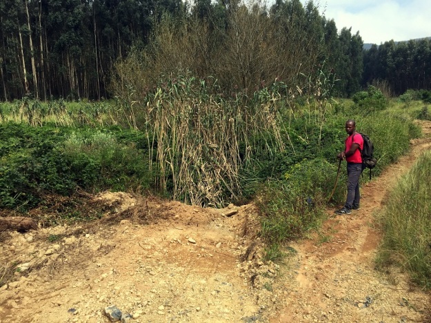
From this point on, the condition of the river bank vegetation also declined considerably with a proliferation of alien invasive vegetation, particularly bramble, which required frequent bushwhacking and made walking close to the river very difficult. We had to take a number of detours around or through plantations and lost sight of the river for a fair distance, often due to a hedge-like wall of bramble that separated us from the river.

IMG_6263

Wall of Bramble separating us from the river

We also came across 2 large areas of erosion on exposed, steep river banks.

IMG_6265

Riverbank erosion causes increased sediment deposit in rivers during rainy and stormy weather which leads to the silting up of rivers and dams.

While gazing at the extent of the erosion, a bushbuck suddenly bolted out and made a quick disappearance again. What a treat to see one of these shy antelope! Another boost to our spirits was coming across a few more forest patches with giant-size Bushwillows, Cape Chestnuts and Cabbage Trees.

Three noteworthy sightings from today can adequately be summed up as – The Good, The Bad and the Ugly.

IMG_5919

The Good – Beloved Bushwillows

IMG_6261

The Bad – Formosa Lilies (Lilium formosanum) an emerging weed, which despite its aesthetic appeal is spreading rampantly.

IMG_5953

The Ugly – Bulldozer activity, altering the river banks and clearing vegetation. Such disturbance is likely to attract more invasive weeds.

When we finally got back to the river’s edge and put some of the more difficult terrain behind us, we came to one of the five fixed sampling points where water quality and river flow is sampled weekly by GroundTruth. This is part of a river monitoring project for the Karkloof Irrigation Board, funded by WWF-SA, along the Karkloof and Kusane Rivers. We were encouraged to find a stonefly at this site, doing a fine display of “push-ups” for us, whereby it pushes its body up and down with its legs which is one of the distinguishing features of stoneflies compared to other aquatic invertebrates.

IMG_5993

Our “bodybuilder”, the Stonefly which was doing push-ups for us.

Seeing time fly by, we had to press on to try reach the pick up point before dusk. A new landscape lay before us of beef grazing peacefully on rolling hillsides, maize lands and lush dairy pastures. The change in land use was also coupled with a change in river characteristics, as the river flow slowed down over flatter floodplain terrain, and began to meander more and more.

IMG_6001

After a long day, seeing our trusty steed comes into view (a certain white Prado) was truly a welcome sight – and one which deserved a silly photo to celebrate!

IMG_5982

SAPPI Saunter

River Walk Banner Logo small

On Monday, 27 March the eager walkers were greeted with a clear sky for Day 2 of the Karkloof Catchment to Confluence River Walk. We were thrilled to have Hlengiwe Ndlovu, an environmentalist for Sappi, join us for the day and share her expertise and knowledge with our team for this vitally important project.

IMG_5830

Day 2 River Walkers. From Left: Sue Viljoen (WWF-SA), Hlengiwe Ndlovu (SAPPI), Twané Clarke (Karkloof Conservancy), Nduduzo Khoza (EWT) and Ayanda Lipheyana (GroundTruth)

The team were dropped off at the same point that we ended at on the previous day and started a new Riparian Health Audit (RHA) to measure the quality of the upcoming river stretch. A miniSASS study along with water chemistry tests were also conducted.

IMG_6257

Testing water clarity

The journey along this first RHA section yielded a “Fair” result, which had been the lowest score we’d gotten since the source of the Karkloof river. We anticipated that the results would show a decrease in river health, as we had come across the first sign of humans since starting on our walk.

IMG_5772

Signs of human life (a rare sight since Day 1’s walk)

Hlengiwe was enthusiastic about the River walk: “I think the project will provide valuable “point information” of where/what impacts occur along the river for the landowners to enable targeted action. It will also be worthy in providing positive feedback to landowners who’ve completed good rehabilitation interventions.

IMG_5825

Hlengiwe Ndlovu (SAPPI) was thrilled to walk along the Karkloof River with us.

This RHA area was badly infested with Wattle and Bramble; there were signs of litter and small scale dumping; and Ayanda Lipheyana of GroundTruth pointed out the “Sewerage plant” which grows along river banks where there is a high nutrient load in the water. This warranted a sample to be taken for E. coli, Nitrate and Phosphate tests to be done. These samples are sent daily to Talbot and Talbot who have kindly donated their time, equipment and expertise for this project.

IMG_5774

A portion of the Bramble infestation.

We soon entered Plantation territory, where the team were treated to interesting stories from Hlengiwe about the challenges they face when planning Invasive Alien Plant control within the plantation areas.

IMG_5787

This walk has inspired some valuable discussions while sharing thoughts and ideas.

The team were impressed with the progress that has been made by SAPPI in the stretch we were walking for the day.


IMG_5829

Appreciating the healthy looking riparian zone between the two plantations.

The riparian zones were looking healthy and we had an easy walk through the grasslands, appreciating the lack of bramble hooking onto our clothes and skin.

IMG_5806

The team enjoying a bramble-free walk

Hlengiwe pointed out the Bracken in a few areas, telling us about the nightmare in trying to control this pioneer species. This plant is a common sight in the KZN Midlands, turning a beautiful golden brown colour in the autumn. There was a consensus in the discussions between the team that the most effective way in controlling the spread of this plant is to keep it short and cut the regrowth at its early stages.

IMG_5826

Hlengiwe Ndlovu (SAPPI) pointing out the Bracken that proves difficult to remove.

As the team saw their homestretch to the end of day 2, Ayanda’s foot managed to find an animal’s home on the grassland slope, unfortunately twisting his ankle in the process. One of the dangers of walking through unpathed areas.

IMG_5824

Ayanda getting his ankle strapped by Nduduzo to help him reach our end point at the bridge in the background.

Hlengiwe commented: “I enjoyed being up close and personal to the river, which is a rare opportunity as one often sees the river in bits and pieces. I also enjoyed the anecdotal stories from the team of the different “river experiences” we’d all had and how we’ve all experienced the Karkloof thus far.

IMG_5828

A happy team at the end of Day 2. From left: Nduduzo Khoza (EWT), Ayanda Lipheyana (GroundTruth), Hlengiwe Ndlovu (SAPPI), Charlie MacGillivray (Karkloof Conservancy and our amazing backup, support and driver), Twané Clarke (Karkloof Conservancy), Sue Viljoen (WWF-SA)

Our sincere thanks to all sponsors and landowners who have made this walk and study possible. So far it has proven to be an extremely valuable exercise and we look forward to the rest of the journey.

Source Seeking and Catchment Clambering

River Walk Banner Logo small

Clamber (verb): to climb or move in an awkward and laborious manner, typically using both hands and feet.

This sums Day 1 up quite adequately, especially whilst we were trying to find the source of the Karkloof River! The source proved to be well hidden within a thicket of Ouhout, Leucosidea sericea, mixed with some other indigenous shrubs and trees such as the Nana-berry, Searsia dentata, and a few ferns and creepers.

Source team

The river walk team at the source of the Karkloof river

The river walkers were ready to start their intrepid journey of the first 10.6km of the Karkloof River at 7am, with a light misty drizzle – typical of the Midlands mistbelt. Our team comprised of Twané Clarke of the Karkloof Conservancy, Ayanda Lipheyana from GroundTruth who do routine water quality monitoring for the Karkloof Irrigation Board, Sue Viljoen of WWF-SA who have been working on a number of Water Stewardship initiatives in the Umngeni catchment, and Nduduzo Khoza an Eco-Ranger for the Endangered Wildlife Trust (EWT).

River walk team

Off we go… From left: Sue Viljoen (WWF-SA); Nduduzo Khoza (EWT); Ayanda Lipheyana (GroundTruth); and Twané Clarke (Karkloof Conservancy)

The team followed the stream until they reached a sight with sufficient water to begin the first set of water quality sampling techniques. These methods will be repeated down the length of the Karkloof river to build up a better picture of the river’s current status quo.

MiniSASS

MiniSASS – identifying the invertebrates to determine river health

Tests included a miniSASS (using aquatic invertebrates to determine river condition), a Riparian Health Audit (RHA) and taking water quality readings such as pH, clarity, dissolved oxygen and temperature. All results have been captured on smart devices using a new app called GeoODK, which GroundTruth have customised for river monitoring purposes.

IMG_5618

Testing the clarity of the water

Most miniSASS tests indicated good condition, with one site boasting near natural conditions. The highlight of the day was finding an elusive Stonefly at this site which is known to be the most sensitive invertebrate to river impacts.

stone fly

Yes folks, that little insect made our day!

The site that only had a fair condition was possibly indicating the impact of erosion, invasive alien vegetation and log jamming.

log jamming

An example of log jamming. Removing these obstacles in the river will make a world of difference.

We were all fascinated by the abundance of Ouhout growing  along drainage lines, gullies and riverine areas. We’re particularly interested to find out from the locals about the history of this area and whether these trees have always been here or if it has gotten denser through the years – ideas welcome.

Ouhout

Overall, we were quite surprised by the extent of the impacts so soon in the river’s journey. Wattle, Bramble and Blackjack are prevalent and will require large scale and carefully planned clearing, with assistance of other organisations, if the vision of an alien free Karkloof river is ever to be realised.

bush whacking

We were also treated to some of the most beautiful scenery,

Panoramic view

unique flowers,

purple flower

spoor of what we suspect to be a Brown Hyaena that we followed for a while,

Hyaena spoor

and lots of frogs.

Ndu Kisses a frog

As the sun began to set over the picturesque hills, we realised we were chasing the clock to reach our final point before dark. The flying ants glistened in the dusky light and the temperatures began to drop.

sunset flying ant photo

The team finally reached the end at 6:30 pm where we were warmly greeted by Charlie MacGillivray who is both a landowner and the Chairman of the Karkloof Conservancy. Let’s hope Day 2’s stretch of the Karkloof river is kinder to us.

Our sincere thanks to all landowners who gave us permission to walk on their properties today. We thoroughly enjoyed exploring your part of the Karkloof which set the tone for the rest of the journey.

Don’t Fiddle With our Water Factories

In nature, there is no magic water factory – the water on the earth now is the same water that has been here since the beginning of time. Whether in the Karoo or the forests of the Congo, the basics of the water cycle are the same: Water falls on the land as rain, snow, sleet, hail and mist, runs into our rivers, fills our dams and underground aquifers, and flows out to the oceans. The sun evaporates this water, clouds form and some of it falls again on the land. This is the water that we all use. Only 3% of the water on our planet is freshwater (as opposed to saline) and only 1% is available for our use.

f

South Africa is a water scarce, semi-arid country, and unfortunately, even the little water we do have is often badly managed, used wastefully and polluted. It seems crazy then that hydraulic fracturing (fracking), which uses a lot of water AND contaminates water, should even be considered an option to boost our energy resources! A number of technical cooperation permits have been issued in the Midlands and Berg foothills, which give the holders rights to research the area as a desktop exercise with a view to fracking. In order to verify the amount of shale gas present and its viability as an energy source, prospecting or exploration as it is termed in the oil and gas sector, will need to take place. This activity has the potential to affect groundwater quality as it uses hydraulic fracturing techniques.

f13

The KZN Midlands is a National Freshwater Ecosystem Priority Area. The role of the Drakensberg and foothills as the ‘water factories’ of Kwa Zulu Natal cannot be underestimated. Intact grasslands are important for storing rainwater in wetlands or as ground water which is gradually released throughout the year. It is vitally important to protect these areas which sustain the flow of clean water, supporting the lives and livelihoods of nearly 6 million people downstream. Other free ecosystem services provided by these Midlands grasslands include pollination, soil production, flood water attenuation, carbon storage, cultural and recreational amenities and support to subsistence livelihoods. The uMngeni River catchment supplies 1000 million litres per day of potable water to a vast area including Howick, Hilton, Edendale, Wartburg, Vulindlela, most of Durban and Pietermaritzburg.

f6

The Midlands Conservancy Forum (MCF) opposes, on ecological, social and economic grounds, the use of fracking to recover natural shale gas. Specifically, the MCF believes that the risk of contamination of groundwater in an already water-stressed environment is simply unacceptable. Despite assurances from potential extractors that the technique is safe, evidence of failed safety measures and resultant contamination is increasingly common in areas where fracking has been undertaken, even under first world conditions. We can’t drink gas! Want to be better informed about this issue?

f15

Learn more here: http://www.midlandsconservancies.org.za/prpagefracking.php

Fracking – Boom, Bust, Banned?

Despite the occasional drizzle this summer, we have not had our usual rainfall.  We are experiencing a drought as anyone who observes dam levels will have noticed.   Can you imagine the state we would be in if frackers had contaminated our groundwater?

Prospecting licences to explore fracking options in KZN may not seem like such a great asset following the news that New York State has banned fracking.  However, we still need to be on the alert as the opportunity to make some money in the short term is usually high on the agenda of mining companies.

The Midlands Conservancies Forum falls within a National Freshwater Ecosystem Priority Area.   In order to determine the amount of shale gas present in the Midlands and its viability as an energy source, prospecting will need to take place.  This activity has the potential to affect ground-water quality.

A collation of some recent articles about some of the issues that have hit the headlines recently, follows.f13

Increased production from US fracking operations is a major reason for the drop in oil prices, but there are warnings that the industry now faces a crisis. There’s no doubt that US-based fracking – the process through which oil and gas deposits are blasted from shale deposits deep underground – has caused a revolution in worldwide energy supplies. Yet now the alarm bells are ringing about the financial health of the fracking industry, with talk of a mighty monetary bubble bursting − leading to turmoil on the international markets similar to that in 2008. In many ways, it’s a straightforward case of supply and demand. Due to the US fracking boom, world oil supply has increased.

Glut in supplies But with global economic growth now slowing – the drop in growth in China isparticularly significant – there’s a lack of demand and a glut in supplies, leading to a fall in price of nearly 50% over the last six months.

Fracking has become a victim of its own success. The industry in the US has grown very fast. In 2008, US oil production was running at five million barrels a day. Thanks to fracking, that figure has nearly doubled, with talk of US energy self-sufficiency and the country becoming the world’s biggest oil producer – “the new Saudi Arabia” – in the near future.

The giant Bakken oil and gas field in North Dakota – a landscape punctured by thousands of fracking sites, with gas flares visible from space – was producing 200,000 barrels of oil a day in 2007. Production is now running at more than one million barrels a day. The theory is that OPEC is trying to drive the fracking industry from boom to bust

Fuelled by talk of the financial rewards to be gained from fracking, investors have piled into the business. The US fracking industry now accounts for about 20% of the world’s total crude oil investment. But analysts say this whole investment edifice could come crashing down.

Fracking is an expensive business. Depending on site structure, companies need prices of between $60 and $100 per barrel of oil to break even. As prices drop to around $55 per barrel, investments in the sector look ever more vulnerable. Analysts say that while bigger fracking companies might be able to sustain losses in the short term, the outlook appears bleak for the thousands of smaller, less well-financed companies who rushed into the industry, tempted by big returns he fracking industry’s troubles have been added to by the actions of the Organisation of Petroleum Exporting Countries (OPEC), which, despite the oversupply on the world market, has refused to lower production.

The theory is that OPEC, led by powerful oil producers such as Saudi Arabia, is playing the long game – seeking to drive the fracking industry from boom to bust, stabilise prices well above their present level, and regain its place as the world’s pre-eminent source of oil.

There are now fears that many fracking operations may default on an estimated $200 billion of borrowings, raised mainly through bonds issued on Wall Street and in the City of London. In turn, this could lead to a collapse in global financial markets similar to the 2008 crash.

Existing reserves

There are also questions about just how big existing shale oil and gas reserves are, and how long they will last. A recent report by the Post Carbon Institute, a not-for-profit thinktank based in the US, says reserves are likely to peak and fall off rapidly, far sooner than the industry’s backers predict. The cost of drilling is also going up as deposits become more inaccessible.

Besides ongoing questions about the impact of fracking on the environment − in terms of carbon emissions and pollution of water sources − another challenge facing the industry is the growth and rapidly falling costs of renewable energy.

Fracking operations could also be curtailed by more stringent regulations designed to counter fossil fuel emissions and combat climate change. Its backers have hyped fracking as the future of energy − not just in the US, but around the world. Now the outlook for the industry is far from certain. – Climate News Network

f15

The Economist published an article entitled Sheiks vs Shale in December – a different take on the same issue. An extract:

In June the price of a barrel of oil, then almost $115, began to slide; it now stands close to $70 (ML – that was in December; now $47!). This near -40% plunge (ML – now nearly -60%!) is thanks partly to the sluggish world economy, which is consuming less oil than markets had anticipated, and partly to OPEC itself, which has produced more than markets expected. But the main culprits are the oilmen of North Dakota and Texas. Over the past four years, as the price hovered around $110 a barrel, they have set about extracting oil from shale formations previously considered unviable. Their manic drilling—they have completed perhaps 20,000 new wells since 2010, more than ten times Saudi Arabia’s tally—has boosted America’s oil production by a third, to nearly 9m barrels a day (b/d). That is just 1m b/d short of Saudi Arabia’s output. The contest between the shalemen and the sheikhs has tipped the world from a shortage of oil to a surplus.

There are signs that such a shake-out is already under way. The share prices of firms that specialise in shale oil have been swooning. Many of them are up to their derricks in debt. Even before the oil price started falling, most were investing more in new wells than they were making from their existing ones. With their revenues now dropping fast, they will find themselves overstretched. A rash of bankruptcies is likely. That, in turn, would bespatter shale oil’s reputation among investors. Even survivors may find the markets closed for some time, forcing them to rein in their expenditure to match the cash they generate from selling oil. Since shale-oil wells are short-lived (output can fall by 60-70% in the first year), any slowdown in investment will quickly translate into falling production.

This shake-out will be painful. But in the long run the shale industry’s future seems assured. Fracking, in which a mixture of water, sand and chemicals is injected into shale formations to release oil, is a relatively young technology, and it is still making big gains in efficiency. IHS, a research firm, reckons the cost of a typical project has fallen from $70 per barrel produced to $57 in the past year, as oilmen have learned how to drill wells faster and to extract more oil from each one. The firms that weather the current storm will have masses more shale to exploit. Drilling is just beginning (and may now be cut back) in the Niobrara formation in Colorado, for example, and the Mississippian Lime along the border between Oklahoma and Kansas. Nor need shale oil be a uniquely American phenomenon: there is similar geology all around the world, from China to the Czech Republic. Although no other country has quite the same combination of eager investors, experienced oilmen and pliable bureaucrats, the riches on offer must eventually induce shale-oil exploration elsewhere. The Economistf7

You are welcome to use the info-graphics included in the post as you wish. Should you prefer high resolution images, or others useful for use as email, Facebook or website banners, please email info@midlandsconservanciesforum.org.za and we will send them to you.

For more information and other interesting articles, see: http://www.midlandsconservancies.org.za/prpagefracking.php


Thukela in Trouble

Many people are concerned about the state of our water resources and rivers.  Judy Bell wrote this article after reading about the discussions at a recent Thukela River’s Simunye Environmental Forum meeting. They should be a wake-up call for us all.

There is a concern that this years’ flow has been the worst experienced in recent years, which is a problem as the Bulk Water Abstraction hasn’t even started yet. The River reserve is 6 cubic metres per second (cumecs) and the river level came down to 5.4 cumecs in September. Concerns were raised that there are a lot of developments coming in and these figures are worrying.  Also noted was the fact that Sappi Tugela Mill’s water abstraction rate is below 35Ml and decreasing – as they are continuously optimising processes; and that there is an off-take of ±7 cumecs for municipal use.

r tugela river

Thukela River from the N3

Judy writes:

This also really disturbing in view of all the water supply allocations for Richards Bay’s developments that will (and already do) rely on the Thukela River and the essential role of the Thukela Bank for the fishing industry up and down the coast and the health of the Estuary.

The same has occurred down the south coast with Sappi Saiccor having to stop production at around the same time due to low river flows – this even before the impacts (which will further reduce flow) from the anticipated Smithfield dam being planned for the Mkhomazi River!

There is a general lack of understanding of the link between rain and the ecosystems that sustain flows of good quality water on the one hand and on the other, the negative impacts we have on these life support systems from inappropriate development in the catchment, including the built infrastructure for storing and conveying water. 

There is an increase in demand for water throughout KZN (and elsewhere, with export of our water to other provinces) due to increase in population and a move to urban areas.  This in turn drives  development of the remaining open/green/natural spaces, additional dams and inter-basin transfers.  We are now affecting the functioning of the remaining ecosystems responsible for the continuous flows of good quality water.  This will have a further effect on the capacity of these life support systems to provide us with the essential basics for daily living.

MINOLTA DIGITAL CAMERA

Water does not come from a tap!  We cannot continue to transform/develop the grasslands and forests (or allow deterioration from alien invasive plants and erosion) at the current rate, especially the watersheds and the aquatic ecosystems they support, on their life-sustaining journey to the sea.  Investment in ecological infrastructure is essential before we build more dams or transfer more water between catchments to support growth that is unsustainable – there are limits to growth and the availability and quality of water is setting the boundaries, whether we like it or not.

r sheep wetland de beers pass 091

There is hope – It is cheaper to invest in the catchment than it is to build dams and interbasin transfer systems.  Using Working for Water and DUCT’s (Duzi uMngeni Conservation Trust) figures, Kevan Zunckel calculated the following and concluded that ecological investment is a no-brainer:

  • ± R40 000/month is needed for every kilometre of river rehabilitation (invasive alien plant and erosion control)
  • improves the aquatic assimilative capacity and help mitigate the impacts of climate change too
  • positively affects the river health and that of those living closest to the rivers and who rely on the resource (usually the poor)
    • It currently costs the eThekwini Metro around R 100 million/month to treat river water to potable water standards (Neil McLeod provided this figure, some say it may be half that – gobsmackingly huge no matter which one is used!)
  • This would reduce the ever-increasing costs of water treatment
  • It would also provide much needed work for people living in the catchment.
  • Avoid loss of dam capacity due to siltation and pollution (they cost a fortune!!)
    • a new dam lost 70% of its capacity in 3 years due to sediments from the degraded catchment
    • some KZN dams can no longer be used due to the silt load and/or eutrophication but were built at great cost (financial, social and environmental).

As a result, eThekwini Metro, Msunduzi Local and uMgungungdlovu District Municipalities have started to invest in ecosystems and this needs to be replicated around KZN by all spheres of government, industry and communities alike.

We have all felt the violence of service delivery protests from community frustration at just a local level.  Can you imagine what will happen when all the taps run as dry as the rivers that supply them?  The back lash from the electricity load shed we are currently (pardon the pun!) experiencing will be piddling in comparison.

We need to ensure that people understand this is a finite resource and everyone cherishes every drop and protects the ecosystems that struggle to provide for our needs.  Please help to inform and inspire your colleagues, friends, family and networks.

Some quick reads:

Penny is Our Eco-Warrior

Midlands Conservancies Forum nominated Penny Rees – the intrepid River Walker and environmental activist – for the Eco-Logic Awards this year. She did not win the title Eco-Warrior, but we are adamant that she should have.

Penny has lived beside some of Africa’s most famous rivers Timbavati, Limpopo, uMkhomazi, and now the uMngeni. She first met the uMngeni River as a young intern at WESSA’s Umgeni Valley Reserve in the 1980’s. When she returned to run their Environmental Education Programme a few years ago, she observed a marked decline in river health.Penny2010_0708_104904

Her concern led her to DUCT (the Duzi uMngeni Conservation Trust), whose mission is to champion the health of our rivers. She soon became an integral part of the team, monitoring the uMngeni River and submitting comments on development proposals.   This is the river that works the hardest in our province of KZN and is suffering as a result. She started to dream about a walk from Source to Sea and developed an action plan to make this a reality.

Mayday for Rivers 2013 - Walking the Lions 372

During May 2012, Penny lead a team of volunteers to walk 311 kms from uMngeni Vlei to Blue Lagoon in order to raise public awareness about the plight of the uMngeni river. This captured the public’s imagination as daily updates were posted on their blog. Judy Bell, Chair, Midlands Conservancies Forum (MCF) said: “Most of us fear to dream so big, let alone work to realise the dreams to do more for the environment, but Penny did so courageously. The awareness raised has been invaluable to all those doing their bit to improve our planet’s ecosystems. She has done us all proud.”

Penny is quiet

The walk not only highlighted the plight of this important source of water, but gathered data that is being used extensively by other organisations working to protect water and other ecosystems that are our life support systems. Penny compiled a comprehensive report which included 26 miniSASS scores, all the negative impacts (invasive vegetation, erosion, poor farming practices and pollution) and recommended tourist trails along the river banks to improve surveillance and monitoring.

“Interest and enthusiasm for this sort of initiative has spread widely, illustrating what committed and keen individuals can do to make a difference, showing landowners how they can better manage these precious systems and influencing the way authorities are viewing our water resources. Data gathered has illustrated the greatest pressures on these systems. This work could, and is hoped will, become a national initiative undertaken by committed and caring citizens around the country.” Dr Mark Graham Groundtruth

Penny making notes in the Dargle river res

Penny is admired by her peers and environmental organisations for the very important work she does, contributing to the understanding of how theory and reality intersect. “Penny’s commitment is passionate and, impressively, much of her effort is voluntary. Her findings have been a wake-up call and have truly set a benchmark.” Barry Downard, Dargle Conservancy.

During the epic uMngeni walk, Penny realised that the many tributaries have an enormous impact on water quality. Since then, she has explored the Lions and Dargle Rivers and plans to do the Indezi in September and Mpofana in October 2014. Penny is always willing to share her knowledge and has presented numerous illustrated talks, gently pointing fingers at wrong-doers and suggesting remedial action. She hosts regular water workshops in streams and rivers to teach the community how to conduct simple miniSASS tests to monitor river health.

Dargle River Workshop 068

Andrew Anderson, river bank landowner comments “Thank you for showing us that this is not only about the ‘science’ of a healthy river system but equally importantly it is about the people and communities that live along its course. Thank you for the encouragement your bold project is having in urging me to take up the challenge to protect it AND to find ways of engaging with government, on behalf of the millions of people who are indirectly dependent on the uMngeni and her tributaries, to support landowners in conserving and managing its integrity.”

Penny and her team have a dream of a world where everyone understands how essential rivers are for all life on our planet. Preven Chetty is a regular member of the River Walk team: “Penny has been a tireless coordinator and without her diplomatic organising, the team might have been thrown off properties long ago. I feel honoured to be a part of her team. Besides the important data collection, she brings a spiritual aspect with daily water blessings and communion with the rivers. Penny is a true eco-warrior.

Mayday for Rivers 2013 - Walking the Lions 348

Penny received two awards in recognition of her tireless efforts on behalf of our rivers – WESSA KZN’s Environmentalist of the Year and DUCT’s Chairman’s Award.

Kevan Zunckel of Zunckel Ecological & Environmental Services, who compiled the uMgungundlovu Municipal District’s Strategic Environmental Assessment, says “It is interesting to consider the difference in impact between the walks that Penny does and the water quality sampling of an institution like Umgeni Water. We get regular monthly reports based on the latter, all showing the seriousness of the situation, and yet nothing is done. These reports are received by many and yet it’s a bit like the frog in the boiling water. However, with the River Walks there is a far greater personal angle to the outcomes, as well as the fact that the water quality sampling is done as part of the walk and is therefore directly linked to what they observe as they walk down river. For me the most valuable insight to come out of the uMngeni walk was the ability of the river to “heal itself” as a direct result of riparian restoration work. It is on the basis of this finding that I calculated the possibility of being able to restore the entire length of the uMngeni River’s main stem for 10% of Durban Water’s monthly water treatment spend. I believe that this estimate played a pivotal role in persuading the Water Service Authorities and other key stakeholders to join the uMngeni Ecological Infrastructure Partnership. These walks play an important role in catalysing action towards the restoration and better management of our catchments. I encourage the key role players in the catchments to follow Penny’s example and put as much energy and passion into their legal responsibilities.”

Penny’s connection to the rivers is a creative and spiritual one which compliments her environmental drive and pursuit of scientific data perfectly. At the end of the uMngeni walk she commented. “Here Mama River is an old lady – after a lifetime of nurturing and unconditional giving, she barely remembers her journey that started gently in the folds of distant hills. A life which began with sparkling, bubbling energetic youth, turned sour from abuse and hurt. If only we could all give back to her as she has given to us.”

Mayday for Rivers 2013 - Walking the Lions 103

Peter Tompson, Chair of Upper uMngeni Catchment Management Forum concludes: “Penny is a remarkable lady. She has been passionate about environmental conservation all her life, much of which has been spent in passing on her broad knowledge to others. Her passion is, however, well-grounded in pragmatism and good sense, which makes her all the more credible.”

It is clear from this submission the esteem in which Penny is held. We believe she has more than earned the title of Eco-Warrior for the impressive contribution she has made to protect the ecosystems on which over 5 million people in KZN rely on a daily basis.

“He who hears the rippling of rivers in these degenerate days will not utterly despair.”  Henry David Thoreau


Duzi at its Dirtiest

This article written by NIYANTA SINGH appeared in The Witness recently:

The current water quality in the Duzi River is at its worst ever.  Environmentalists have raised alarm bells saying “it has been one of the worst summers for water quality”, with a peak in poor quality over the past six months, and are laying the blame squarely at the door of the Msunduzi Municipality, accusing them of neglecting the sewer maintenance section in terms of resources and management time.

camp's drift on Duzi

Previous newspaper reports indicated that the municipality had recorded four burst pipes per day, 520 mainline blockages and an ageing asbestos cement pipeline.

The last test done by the Duzi-Umngeni Conservation Trust (DUCT) on March 18 shows alarming figures of E. coli contamination, which is indicative of faecal content in the water and results in severe illness including diarrhoea, kidney failure, abdominal cramping and death. In the Baynespruit River near Greytown Road and Sobantu, the contamination rate of E.coli was a shocking 241 920 per 100 millilitres of water on March 18. Last month, during the Dusi canoe race, the figures for those areas ranged from 6 500/100ml to 14 210/100ml. According to DUCT’s guide, any E. coli contamination greater than 50 000/100ml is a severe contamination and one in three people or canoeists may get sick. The current contamination levels exceed this level more than four times.

Duzi Walk 1 6-10-2012 (45)

DUCT’s Dave Still said any E. coli contamination of 10 000/100ml is considered indicative of fairly significant pollution.  The only acceptable value for drinking water quality, he said, was zero E. coli contamination per 100mls.   No naturally occurring surface water, however, could be expected to have this low level of E Coli contamination. If it does, he said, disinfectants would have been added to the water.

Still said while E. coli data could be hard to interpret as it was extremely variable in time and space, the readings were always higher after rain.  This is partly due to spilling sewers and partly due to wash-off of surface faecal contamination. The last month has been pretty horrible, quality wise, but then it has been quite wet,” added Still. The worrying factor, for him, however, was the long term trend from 1998 to 2013.   This graph shows a score, a single number, for each year, and that score is the number of sites above 10 000 E. coli/100ml each week on average. You want this to be low, not high. As you can see from the graph, the trend is not good,” said Still.

Duzi Walk 1 6-10-2012 (36)

Judy Bell, also an environmentalist, said in addition to changes in the natural infrastructure, which was under huge strain because of growing property developments, the sewer maintenance section was badly neglected in terms of resources and management time.

Another environmentalist who did not want to be named said he did not think it was only failing infrastructure that contributed to the poor water quality.  “I don’t think it’s a question of failing infrastructure. Yes, some of the infrastructure does need upgrading, but that cannot explain a move in the index from 3,3 to 6,4 from 2010 to 2012. It might be a malaise that dates from the time the city went bankrupt, as the team was about to get some much needed equipment but then never got it,” said the source.

Still said in addition to the poor water quality threatening major water sports events, sewage pollution in the Duzi was causing a phosphate build-up in Inanda Dam, which in turn was causing algal blooms.

Mayday 23 582

Dr Mark Graham, also a DUCT Director and one of South Africa’s most highly respected river health scientists said the blue green algae, already seen covering the Inanda Dam this year during the Dusi canoe race, was more insidious and difficult to treat than water hyacinth. “Some of the paddlers would have noticed a unique smell coming up the valley … This was geosmin — a by product of the microcystis algal blooms and a potent taste and odour forming compound which costs huge amounts to treat in potable water. With more nutrient enrichment it will become more prevalent within the dam main basin and could eventually affect water treatment plants in Durban,” said Dr Graham. This algae, he said, had another by-product which was even worse than the taste and odour issue — a group of compounds known as E. coli. “It is highly toxic, particularly if ingested and in sufficiently large quantities. This is a great concern for most water supply companies in the world today as nutrient enrichment increases in most water supply dams,” said Graham.

Duzi Walk 1 6-10-2012 (176)

A DUCT team explored parts of the uMsunduzi river last year. Read about it here:


Winterskloof Gets Wet

Autumn is in the air.  We gathered on a beautiful, sunny, ‘freshly washed’ Sunday morning recently to enjoy the first of the Winterskloof Conservancy Water Workshop series.

DSC_0272

Judy Bell writes:

Penny Rees of DUCT (Duzi-uMngeni Conservation Trust) and Mngeni River Source to Sea Walk fame began the workshop at Cowan House with a discussion about the need to look after our catchments in KwaZulu-Natal.

Our Valley is the watershed for the Dorpspruit, which feeds into the Msunduzi and then into the uMngeni River.  As you can see in the diagram below, the sources of about 12 streams are located right here in our Valley (shaded area) and our properties.  Hence the importance of us all becoming river custodians.

dorpsruit tributaries

Conservancies and communities along the uMgeni River and various catchments are forming partnerships with DUCT to assist in monitoring and protecting the rivers and their catchments in an effort to release more water of good quality into the system.  These workshops held in the Midlands Conservancies are educating communities to monitor rivers in a practical and easy way, so that we can all take action to improve the situation.  A grant from the N3 Toll Concession (N3TC) to the Midlands Conservancies Forum has enabled Penny Rees to run these workshops for the 14 Conservancies that make up the Forum.

The more people who learn to do these easy river health assessments, the more monitoring results will be available for the streams flowing through our properties and neighbourhood.  If we continue to record the results, we will be able to trend the quality with time.

IMG_6718

Penny explained some fast-flowing facts about our water:

  • The uMngeni River arises in the uMngeni Vlei (Nottingham Road area) and flows to Midmar Dam (our drinking water supply) through intensively farmed areas – mainly dairy and pigs, with pollution from fertilizers, effluents and manure slurries, discharging into it.  It is also affected by raw sewage from blocked sewers, especially from the Mthinzima Stream, a tributary arising from the hills above Mpophomeni and flowing into Midmar.  Below the Dam, the river becomes heavily polluted in places as it flows through Howick, affected by contaminated stormwater, litter, raw and treated sewage.  The effluent from the Howick Wastewater Treatment Works flows over the edge of the krantz before the Howick Falls, into the Umgeni Nature Reserve.
  • The river is infested in many places with invasive alien plants such as bramble, bugweed, black wattle (Acacia mearnisii).  This is an invasive native to Australia, which grows unchecked in thickets, with no undergrowth to protect the bare soil, which then erodes easily.  The river previously meandered through grasslands, but with shading by the invasive wattle trees has changed the temperature and pH of the water, which encourages the growth of unhealthy micro-organisms and other plant life, affecting the river’s health.
  • Soil erosion, litter from illegal dumping and storm water drains, treated and untreated effluent all contribute to the deterioration in the health of the river as it makes its way to the sea.
  • Over one thousand million litres of water are abstracted from the uMngeni daily for domestic, agricultural and industrial consumption.  This is not sufficient to meet the increasing demand, which has led to the development of the Spring Grove Dam and Mearns Weir projects in the Midlands, transferring water from the Mooi to the uMngeni River.
  • Water is pumped at great cost from one catchment to another (e.g. Thukela-Vaal) to augment supplies.
  • Only appropriate developments should be allowed near sensitive wetlands and grasslands, which are often viewed as ‘idle land’, when in fact they are performing a life-saving role as water factories and cleaning agents.
  • eThekwini Municipality is currently spending around R1 million each month to clean uMngeni Water to drinking water quality standards and is now working with Msunduzi and uMgungungdlovu Municipalities to invest in the ecological or natural infrastructure that will help increase flows of good quality water into our dams – the wetlands, grasslands, forests in the upper catchments.  This is why the Midlands, with its ‘water factories’, is so important.
  • The River Walks that DUCT undertakes has shown that rivers can ‘heal’ themselves if there is sufficient space between the damaged areas (pollution and invasive alien plant infestations).   In the Cumberland Nature Reserve, this was shown to be a 10 km stretch without pollution, development or alien plant infestations.
  • Monitoring and knowledge of the health of rivers has become a priority, which is why the miniSASS river health assessments (Stream Assessment Scoring System) were introduced, to help citizens join the programme and learn about the water quality in their communities.

Water Quality Monitoring – No High-Tech Equipment needed!

The beauty of this testing system lies in its simplicity.  Anyone can learn how to collect a miniSASS sample on a river or stream, and determine the water quality and health of water resource.  It involves catching and identifying the number and types of macro-invertebrates (small animals) or “nunus” which live in the water.  These are barometers (indicators) of the general river health and water quality. Equipment consists of enthusiastic samplers of all ages using various plastic containers (yoghurt or margarine tubs) with mosquito gauze on top, children’s beach fishing nets and pot plant drip trays for the catch, as well as the miniSASS score card and invertebrate identification booklet.

Sampling the stream 16Mar2014

The group moved down to the Doreen Clark Nature Reserve, just below St Michael’s Road to do a miniSASS on the stream flowing through the reserve.  This stream flows throughout the year through the mist-belt forest, but picks up the run-off from the road and houses upstream, so is not expected to be in “pristine” state.  Under Penny’s guidance, the group quickly collected specimens from the stream amidst lots of ‘oohs, ahhs’ and muddied feet.

IMG_6720

The “catch” was compared with the photographs and placed into groups.  The scores allocated to the different types of organisms was tallied and then divided by the number of groups to which they belonged.  Some organisms carried a higher score, as they are only present in “clean” water.  The stream scored 6.8 which is a rating of fair to good on the miniSASS scale (see Scoring Box below).

winterskloof mini sass score

We hope to involve the schools in the area to develop custodianship of the rivers and streams, to help with regular monitoring of the Valley’s streams’ health and water quality.  The website sass.orasecom.org has further details on testing, identification of the nunus, scoring and registration of the stream as well as a map, geographic coordinates and locations of the river or stream and how to submit test results which should be carried out with a minimum of 6 week intervals to allow the sample site to recover.

DSC_0335

Penny said she thoroughly enjoyed herself and that it was great to see how the younger members got so involved!

SASS – Ecological Category (Condition) Interpretation Score

  • Unmodified (NATURAL)                                                >7.9
  • Largely natural / few modifications (GOOD)       6.8 – 7.9
  • Moderately modified (FAIR condition)                  6.1- 6.8
  • Largely modified (POOR condition)                            5.1 – 6.1
  • Seriously / critically modified (VERY POOR condition)    <5.1

Thanks to all those who joined us for the Workshop, to Cowan House for hosting us, Penny Rees for enlightening us, the Midlands Conservancies Forum and N3TC for funding the Workshop and for those who joined us.  Winterskloof will have another water workshop later in the year in Spring, so watch out for this.  Balgowan Conservancy will host one on 27 April in the Mpofana River.

For more information, check out the DUCT uMngeni River Walk miniSASS and miniSASS websites.

IMG_6719

The Importance of Wetlands in Kamberg

The Kamberg Conservancy used their allocation of the MCF Environmental Learning and Leadership Programme funds for a lesson on the importance of wetlands at Dabulamanzi school for Grades 4,5 and 6.  Nkanyiso Ndlela facilitated the lesson on behalf of the Midlands Meander Association Education Project and MCF.

IMG_1811

When I arrived at school the teacher and the learners were ready for me. I introduced myself and the Midlands Conservancy Forum and the programme for the day. I ask the learners to stand up and we played fun life skills game, where they have to use their two body senses – sight and hearing. I asked the learners to do what I say, not what I would do. So, for example I will say touch your head but I would be touching my toes.

I divided them into three groups and I used the Windows on our World Wetland game as an ice breaker and to tune them into the day’s topic. This game helps learners to develop the skill of identifying and analysing environmental problems and it shows connections, interdependencies, and cause and effect relationships.

IMG_1813

Learners were paying attention and following the instructions. Although this activity created conflict amongst groups, I kept encouraging group work and discussion as a group. They were interacting with one another and asking questions. We discussed the importance of wetlands and the causes of wetland pollution.

We then took a trip to the closest wetland, where we were able to identify negative agricultural impacts on wetlands – for example monoculture. I explained to them that some farmers spray their crops with chemicals and that gets washed down to wetlands.

IMG_1823

Other impacts observed were alien plants – bug weed and bramble, and litter coming from the school and road. We also identified incema, which is a grass used to traditionally make mats.

IMG_1824

We then went back to the class room where each learner shared their experience in the wetland by presenting to the rest of the class.

I then introduced the wetland food web worksheet, asked the learners to draw lines between animals and plants to show who eats who, illustrating how all life in an eco-system is intricately connected.

IMG_1815

I closed the programme by recapping, asking them what they have leant. They response showed that they have learnt something as they could remember the importance of wetlands and also wetland pollution.

Sanele Duma, educator commented “We had a wonderful time. The kids really enjoyed themselves as this was the long awaited field trip. It is also an important part of the curriculum to do this hands on learning. Now they understand wetlands much better. We hope to have another lesson like this. Thanks to the Conservancy.”

IMG_1816